China Eyes Northwest Passage for Shipping
China has issued a shipping guide to the Northwest Passage, reports the state-run newspaper China Daily. Earlier this month, China’s maritime safety administration published the Arctic Navigation Guide (Northwest Passage), a 365-page handbook of nautical charts and sea-ice descriptions that lays the groundwork for ships flying the Chinese flag to travel through the passageway.
Using the route will lower transportation costs for China, a senior official at the maritime administration told China Daily. By using the Arctic route, ships travelling from Shanghai to Hamburg could shave off 2,800 nautical miles from their journey, Reuters reported.
Canada considers the route to fall within internal waters, but other countries feel differently and identify it as an international strait that gives them the right to passage. But China has not revealed its stance on the matter.
“Canada has imposed some restrictions on the use of the Northwest Passage, asking foreign vessels to inform the Canadian side and get permission before entering or crossing its exclusive economic zone and territorial waters,” foreign ministry spokesperson Hua Chunyingtold reporters during a briefing on Wednesday. “The Chinese side will make appropriate decisions by taking into account various factors.”
China has been increasing its presence in the Arctic region, which it sees as having scientific and strategic importance. The Chinese company COSCO sailed ships through Russia’s Northeast Passage in 2013 and 2015. In 2014, the MV Nunavik, a cargo ship carrying nickel concentrate, sailed from Deception Bay to China via the Northwest Passage.
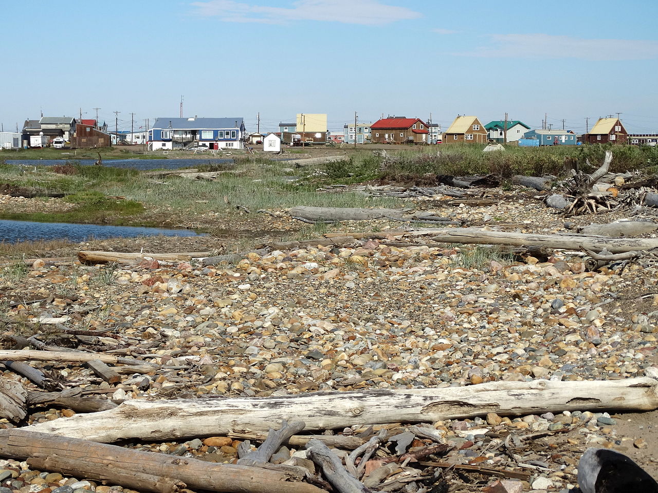
A view of Tuktoyaktuk, Northwest Territories, from the coastline. (CC BY-SA 3.0) (Wikimedia/Adam Jones)
Big Changes in Store for Canada’s Northern Coast
Storms, floods, erosion and more rain and snow. That’s just a taste of what Canada’s northern coastline can expect with climate change, according to a new report, “Canada’s Marine Coasts in a Changing Climate,” published by Natural Resources Canada.
Of course many of these changes are already underway. In Tuktoyaktuk, Northwest Territories, for example, where the land is also subsiding, tide gauges show that the sea level is rising about 2.4mm (0.1in) per year. By 2100, sea levels around Tuktoyaktuk could rise 140cm (55in) and put the community at greater risk of flooding. According to the report, high waters that used to occur once every 25 years may become as frequent as once every four years by 2100.
Tuktoyaktuk has already started planning to relocate some homes and to build a concrete-block wall to prevent erosion, CBC News reported in March.
Trevor Bell, a physical geographer at Memorial University of Newfoundland and one of the report’s lead authors, said the future impacts of climate change must be considered for northern infrastructure planning.
“It is critical that future development be undertaken with an understanding of the dynamic nature of the coast and changing coastal risks in the North,” Bell said in a press release.
Efforts to adapt to climate change in the Canadian north are underway. One such program is SmartICE, which uses satellite and ground-based data to provide real-time information about ice conditions to locals. But the programs haven’t been evaluated on their effectiveness or whether they’re sufficient, the report said.
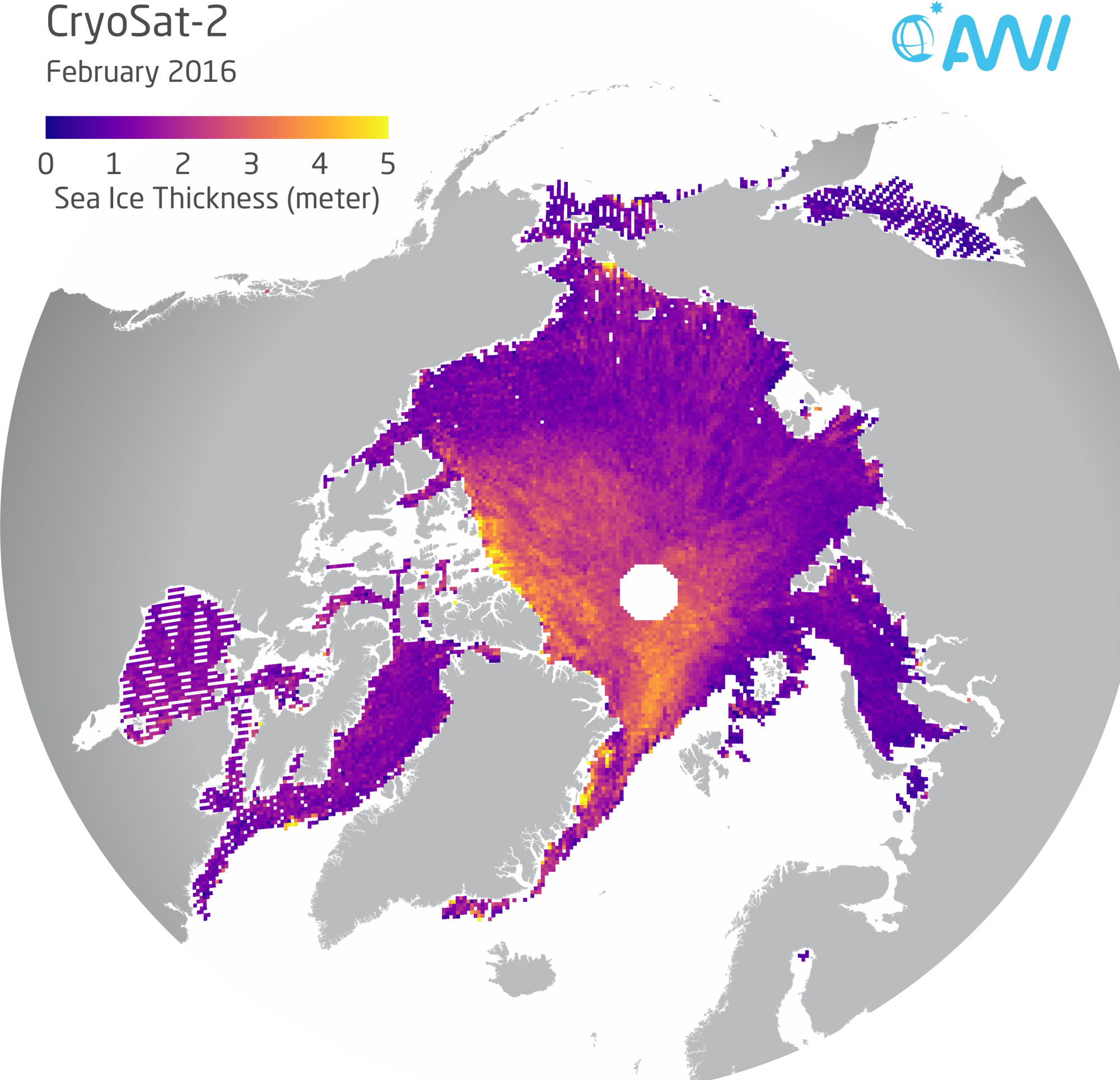
Sea ice thickness in February 2016. (AWI)
Large Amounts of Arctic Sea Ice ‘Too Thin to Survive’
Arctic sea ice could shrink to a record low level this summer, warned scientists speaking at the annual General Assembly of the European Geosciences Union (EGU) meeting in Vienna, Deutsche Welle reported. Data from satellites and “snow buoys” showed that large areas of ice are too thin to survive the summer, according to a press release issued by the Alfred Wegener Institute, Helmholtz Center for Polar and Marine Research.
Landfast ice north of Alaska that is usually 1.5m (5ft) thick now measures less than 1m (3ft).
“New ice formed only very slowly due to the particularly warm winter,” said Marcel Nicolaus, a sea ice physicist at AWI, during a press conference at the EGU meeting.

The blue areas show sea ice that was thinner in February 2016 than in February 2012. (AWI)
The scientists found similarities when they compared this year’s ice thickness map with that of 2012. Carbon Brief reported that Nicolaus said the 2016 summer sea ice could “equal or surpass” the record set in 2012, at 3.41 million square kilometers (1.3 million square miles).